
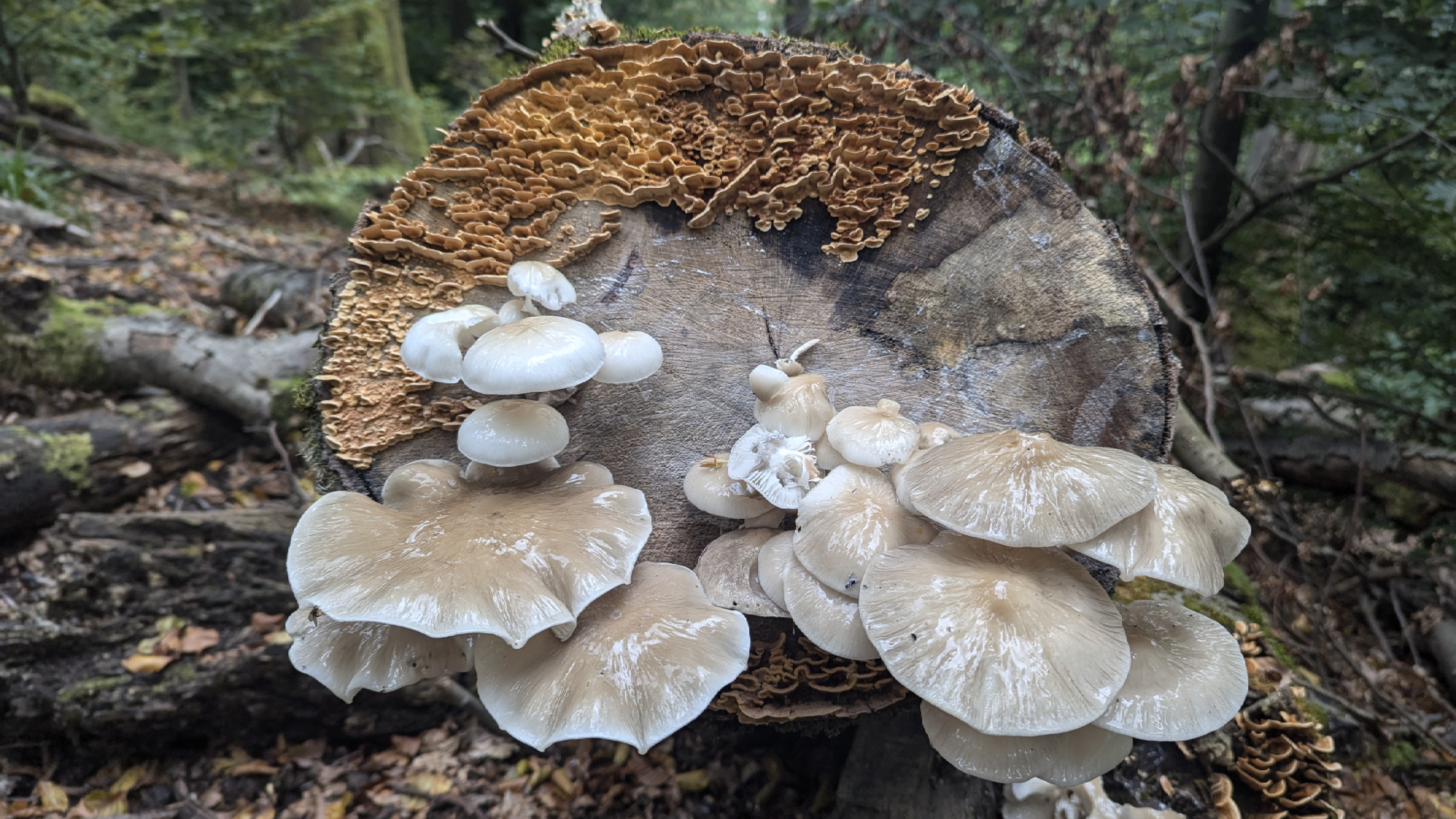
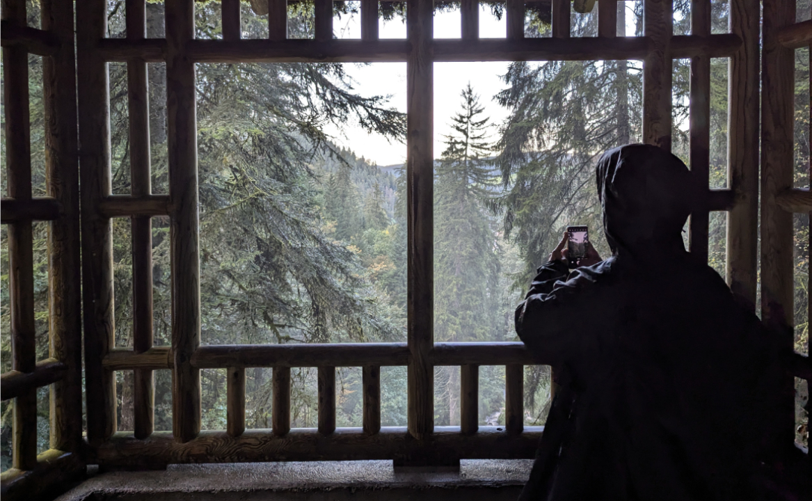
Schwarzwald
What initially were supposed to be 370 km on the bike ended up being less than half. However, it wasn’t easy and was even somewhat dangerous. We were accompanied by two sturdy bikes, a Giant and a Trek, both loaded on either side with clothes, food, and a tent, and they managed to handle dirt, mountains, and roads. The trains in Germany were a great help, both to avoid descents rated as “expert” on Komoot and to dodge 12 mm of rain one night.
The best part of the trip was the physical exercise we had to do, a good kind of tiredness. It had been a while since I subjected myself to such physical effort. It’s interesting to feel the limits of the body and how it deals with stress. Throughout the trip, we had to be mindful of what to eat, when to rest, and plan our next movements accordingly. To all this, we had to add variables like the weather, distances, available modes of transportation, accommodations, and terrain.
 |
|---|
| Triberg waterfalls - Google Maps |
It wasn’t our first trip together; having shared similar experiences helped us a lot in making decisions. Additionally, the German infrastructure contributed to making the trip safer. It was inevitable to constantly compare it with our previous adventures in the Andes or southern Argentina, where one felt more ‘alone’ and, why not, freer.
To my surprise, this trip slightly changed my perspective on Germany and its people. I found people who were friendly and outgoing, willing to strike up conversations. The trains were always a bit late, and both the people and services were quite flexible. It led me to reflect that stereotypes are as important as it is to not pay attention to them.
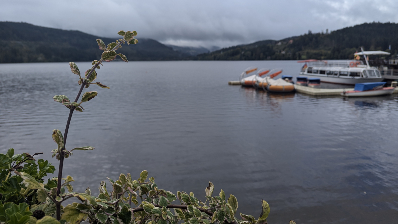 |
|---|
| Titisee Lake- Google Maps |
We visited forests, lakes, castles, and thermal baths. For the most part, we slept in a tent but also in bungalows and some hostels. The coldest night we spent was at 1°C, where I put to the test sleeping with a blanket instead of a sleeping bag.
While the locals were accustomed to cyclists, many were surprised when we told them where we were coming from, even mentioning trains and other shortcuts.
Bike + train is a great combination, providing a good time-to-places-to-visit ratio, where the journey and the paths are part of the destination, not just boring travel hours. The bike allows you to visit nearby places (about 10-30 km) from the main city where the station is and to travel from one town to another when time permits (about 100 km). We both concluded that when biking, you are more in touch with the road and experience it differently. Also, by exercising constantly, the mind works differently.
Komoot helped us a lot in organizing the trip. It provided metrics like difficulty level, estimated time, weather during the route, elevation, road profile (gravel, road, bike path, city, etc.), and comments from other users on similar paths. Google Maps helped us see the train schedules. During the trip, I also used several services that I host at home, including Vikunja for trip information, Emby for listening to music, Simplex for communication, and OpenVPN.
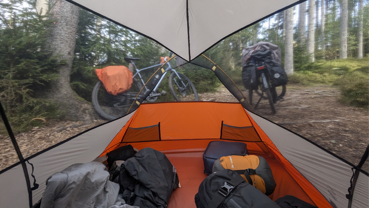 |
|---|
| Tent and bikes at Schwarzwaldcamp, Schluchsee - Google Maps |
As for the equipment, we were well prepared. We researched quite a bit on /r/bikepacking and took advantage of our previous experiences. We bought a large part of the equipment at Decathlon at a reasonable price and also stocked up on some items for future trips.
For the bikes, we had a Trek - Dual Sport 3 Gen 5 and rented another Giant - XTC SLR 29 2 at Zweiradperle, a store I recommend. The side bags, which were waterproof, did their job even in torrential rain; if I remember correctly, the brands were Forclaz and Thule. We also took waterproof clothing, and our tent, a Trek900, was one of the best purchases, easy to set up and take down, weighing only 2 kg.
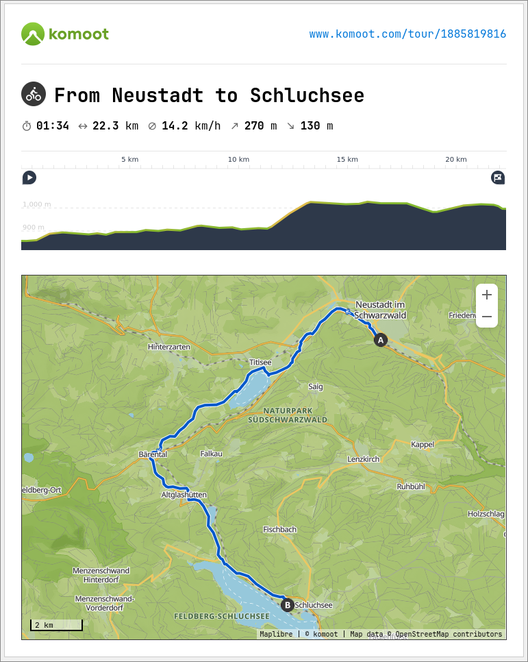 |
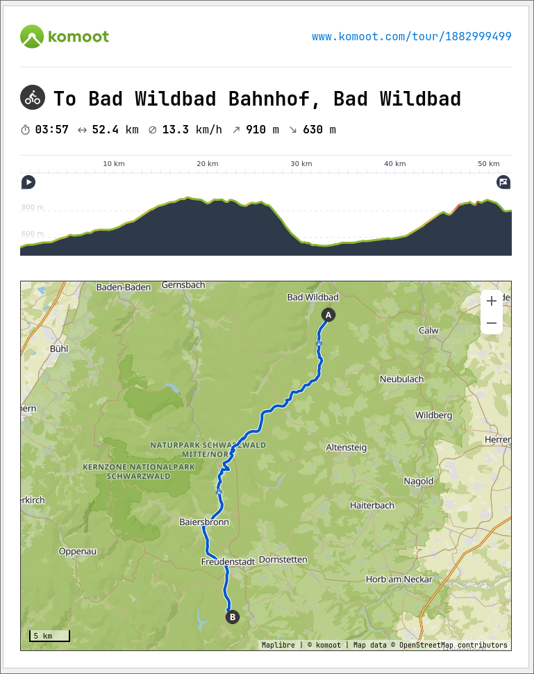 |
|---|---|
| Komoot 1 | Komoot 2 |
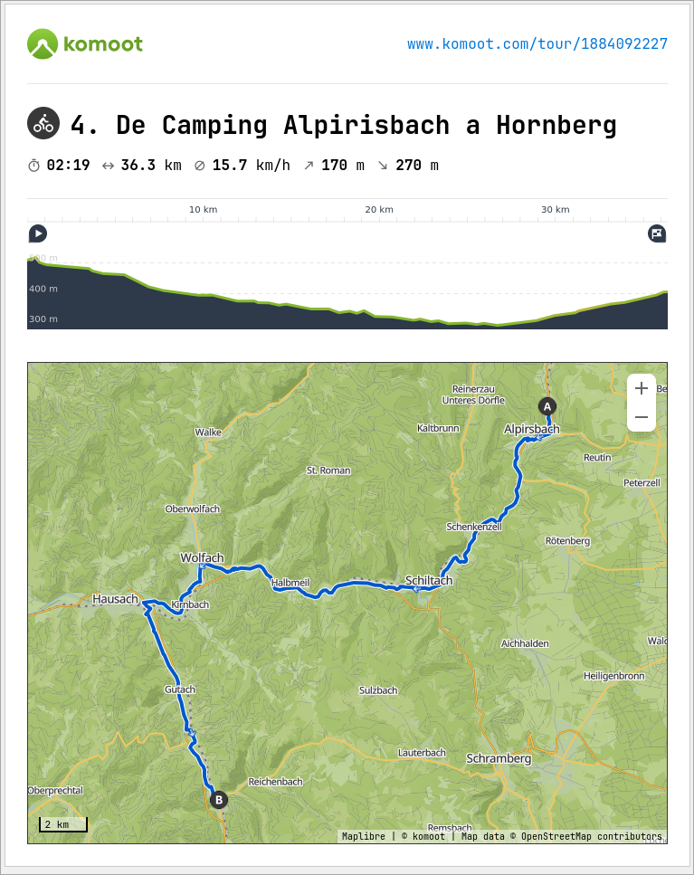 |
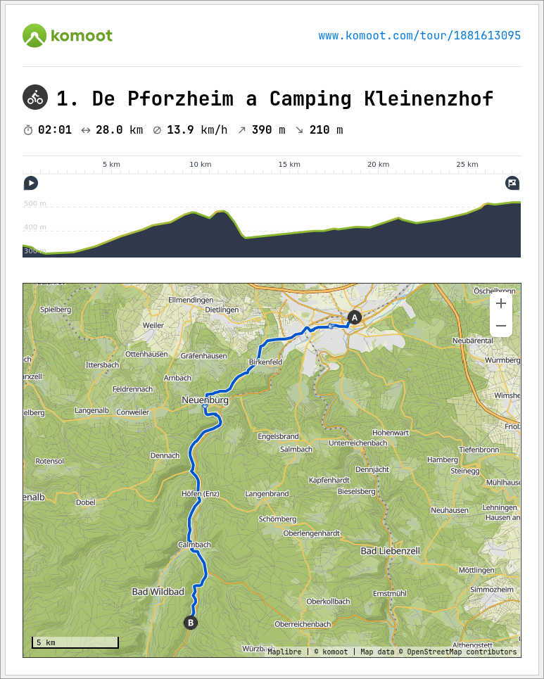 |
| Komoot 3 | Komoot 4 |
These are some of the routes we took. We must have covered a total of 200 km by bike and a fraction of that walking through forests and mountains. The most dangerous part was the biking on roads, where the curves were sharp and the descents steep. The rain and cold didn’t help; at times visibility was low, and sound was muffled. The same applied to cars: most showed quite a bit of respect, but many passed very close, probably because they didn’t see us. This forced us to significantly reduce our speed and make more stops than planned. Additionally, the route often became narrow and two-way, forcing us to maneuver quickly and stay alert.
The trip lasted a total of 9 days and filled with moments that transcended the journey, leaving us with the feeling of wanting to repeat the experience.
Note: Funny thing, I have feed this blog post into Notebook LM (Google’s AI) and it made this totally exaggerated podcast version of the post. Also, I have used ChatGPT to translate the original post which was written in Spanish.